
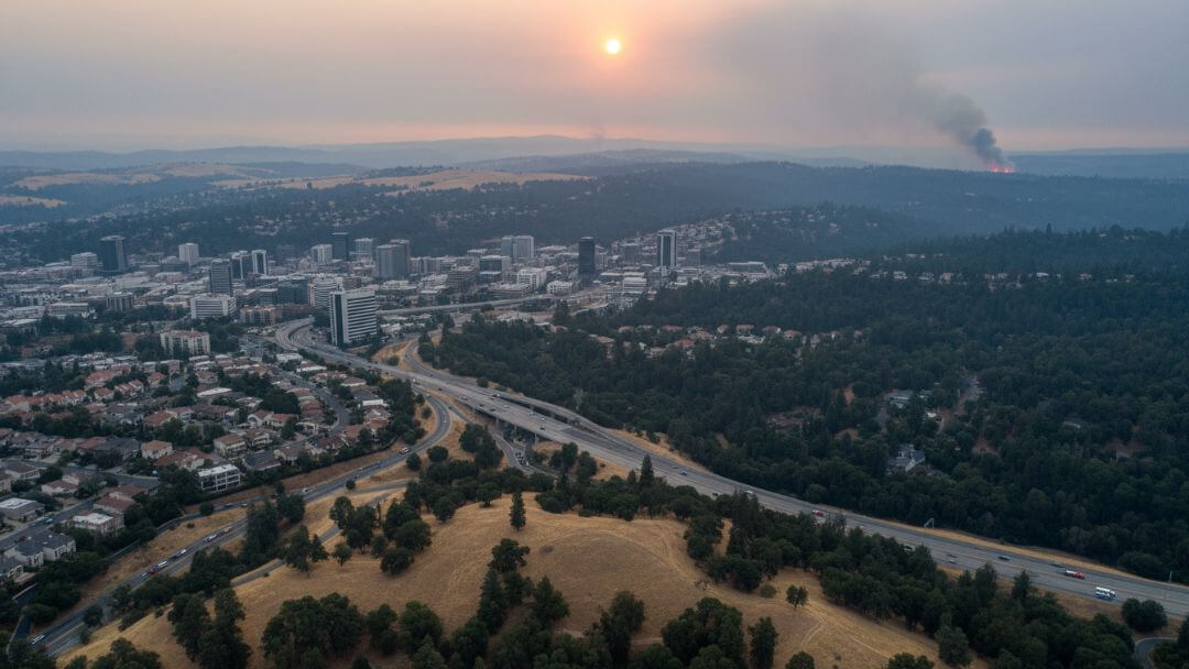
𝐇𝐢𝐠𝐡𝐞𝐬𝐭 𝐰𝐢𝐥𝐝𝐟𝐢𝐫𝐞 𝐫𝐢𝐬𝐤 𝐢𝐧 𝐂𝐚𝐧𝐚𝐝𝐚—𝐚𝐧𝐝 𝐬𝐭𝐢𝐥𝐥 𝐧𝐨 𝐩𝐥𝐚𝐧 𝐟𝐨𝐫 𝐫𝐞𝐬𝐢𝐝𝐞𝐧𝐭𝐬?
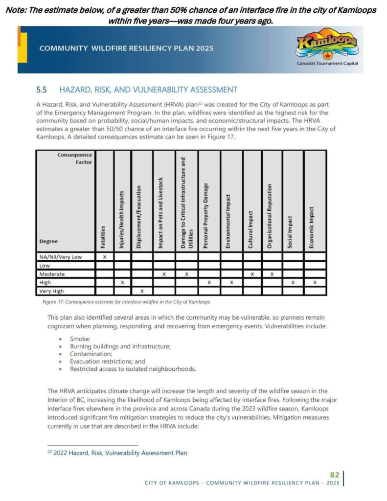
• 𝟒 𝐲𝐞𝐚𝐫𝐬 𝐚𝐠𝐨, 𝐚𝐧 𝐚𝐬𝐬𝐞𝐬𝐬𝐦𝐞𝐧𝐭 𝐝𝐨𝐧𝐞 𝐟𝐨𝐫 𝐭𝐡𝐞 𝐂𝐢𝐭𝐲 𝐨𝐟 𝐊𝐚𝐦𝐥𝐨𝐨𝐩𝐬 𝐞𝐬𝐭𝐢𝐦𝐚𝐭𝐞𝐝 𝐚 𝐠𝐫𝐞𝐚𝐭𝐞𝐫 𝐭𝐡𝐚𝐧 𝟓𝟎% 𝐜𝐡𝐚𝐧𝐜𝐞 𝐨𝐟 𝐚𝐧 𝐢𝐧𝐭𝐞𝐫𝐟𝐚𝐜𝐞 𝐟𝐢𝐫𝐞 𝐢𝐧 𝐭𝐡𝐞 𝐜𝐢𝐭𝐲 𝐰𝐢𝐭𝐡𝐢𝐧 𝟓 𝐲𝐞𝐚𝐫𝐬.
→ What does that mean for residents today?
• 𝐊𝐚𝐦𝐥𝐨𝐨𝐩𝐬 𝐰𝐚𝐬 𝐫𝐚𝐧𝐤𝐞𝐝 𝐭𝐡𝐞 𝐡𝐢𝐠𝐡𝐞𝐬𝐭 𝐰𝐢𝐥𝐝𝐟𝐢𝐫𝐞-𝐫𝐢𝐬𝐤 𝐜𝐢𝐭𝐲 𝐢𝐧 𝐂𝐚𝐧𝐚𝐝𝐚 𝐢𝐧 𝟐𝟎𝟐𝟒, 𝐚𝐧𝐝 𝐭𝐢𝐞𝐝 𝐟𝐨𝐫 𝐡𝐢𝐠𝐡𝐞𝐬𝐭 𝐢𝐧 𝟐𝟎𝟐𝟓.
→ Is Kamloops prepared?
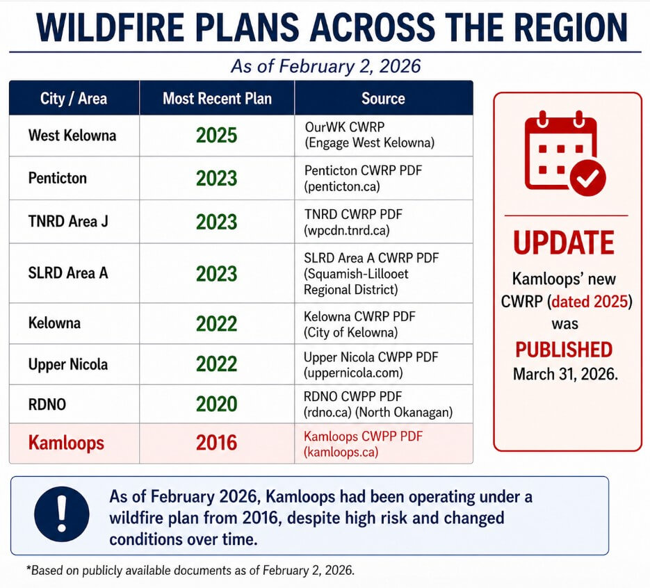
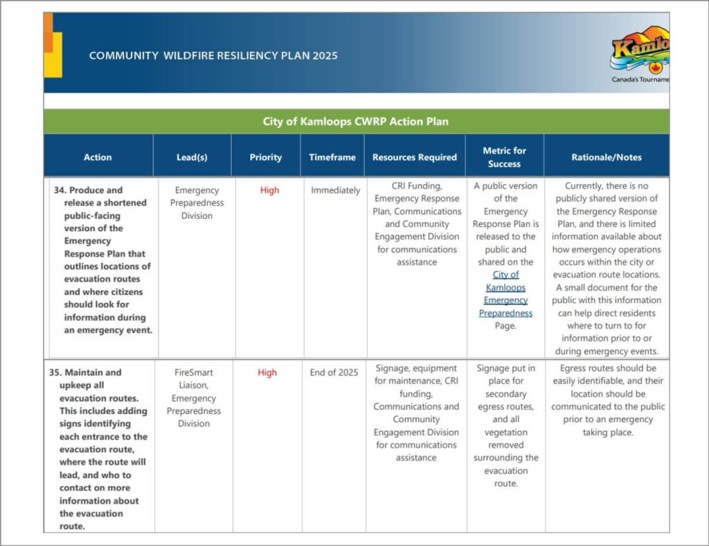
• 𝐓𝐡𝐞 𝐂𝐢𝐭𝐲 𝐨𝐩𝐞𝐫𝐚𝐭𝐞𝐝 𝐮𝐧𝐝𝐞𝐫 𝐚 𝟐𝟎𝟏𝟔 𝐰𝐢𝐥𝐝𝐟𝐢𝐫𝐞 𝐩𝐥𝐚𝐧 𝐮𝐧𝐭𝐢𝐥 𝐥𝐚𝐬𝐭 𝐦𝐨𝐧𝐭𝐡. 𝐀 𝟐𝟎𝟐𝟓 𝐂𝐖𝐑𝐏 (𝐢𝐧𝐭𝐞𝐫𝐧𝐚𝐥 𝐩𝐥𝐚𝐧𝐧𝐢𝐧𝐠 𝐝𝐨𝐜𝐮𝐦𝐞𝐧𝐭) 𝐰𝐚𝐬 𝐫𝐞𝐥𝐞𝐚𝐬𝐞𝐝 𝐌𝐚𝐫𝐜𝐡 𝟑𝟏, 𝟐𝟎𝟐𝟔.
→ Why wasn’t an updated plan in place sooner, as it was in other areas?
• 𝐓𝐡𝐞 𝟐𝟎𝟐𝟓 𝐂𝐖𝐑𝐏 𝐧𝐨𝐭𝐞𝐬 𝐭𝐡𝐚𝐭 𝐭𝐡𝐞𝐫𝐞 𝐢𝐬 “𝐜𝐮𝐫𝐫𝐞𝐧𝐭𝐥𝐲 𝐧𝐨 𝐩𝐮𝐛𝐥𝐢𝐜𝐥𝐲 𝐬𝐡𝐚𝐫𝐞𝐝 𝐯𝐞𝐫𝐬𝐢𝐨𝐧 𝐨𝐟 𝐭𝐡𝐞 𝐖𝐢𝐥𝐝𝐟𝐢𝐫𝐞 𝐄𝐦𝐞𝐫𝐠𝐞𝐧𝐜𝐲 𝐑𝐞𝐬𝐩𝐨𝐧𝐬𝐞 𝐏𝐥𝐚𝐧, 𝐚𝐧𝐝 𝐭𝐡𝐞𝐫𝐞 𝐢𝐬 𝐥𝐢𝐦𝐢𝐭𝐞𝐝 𝐢𝐧𝐟𝐨𝐫𝐦𝐚𝐭𝐢𝐨𝐧 𝐚𝐯𝐚𝐢𝐥𝐚𝐛𝐥𝐞 𝐚𝐛𝐨𝐮𝐭 𝐡𝐨𝐰 𝐞𝐦𝐞𝐫𝐠𝐞𝐧𝐜𝐲 𝐨𝐩𝐞𝐫𝐚𝐭𝐢𝐨𝐧𝐬 𝐨𝐜𝐜𝐮𝐫𝐬 𝐰𝐢𝐭𝐡𝐢𝐧 𝐭𝐡𝐞 𝐜𝐢𝐭𝐲 𝐨𝐫 𝐞𝐯𝐚𝐜𝐮𝐚𝐭𝐢𝐨𝐧 𝐫𝐨𝐮𝐭𝐞 𝐥𝐨𝐜𝐚𝐭𝐢𝐨𝐧𝐬.”
→ When will this information be made available to residents?
• 𝐒𝐨𝐦𝐞 𝐫𝐞𝐬𝐨𝐮𝐫𝐜𝐞𝐬 𝐥𝐢𝐤𝐞 𝐩𝐫𝐞𝐩𝐚𝐫𝐞𝐝𝐧𝐞𝐬𝐬 𝐠𝐮𝐢𝐝𝐚𝐧𝐜𝐞 𝐚𝐧𝐝 𝐞𝐯𝐚𝐜𝐮𝐚𝐭𝐢𝐨𝐧 𝐫𝐨𝐮𝐭𝐞𝐬 𝐟𝐨𝐫 𝐉𝐮𝐧𝐢𝐩𝐞𝐫 𝐑𝐢𝐝𝐠𝐞 𝐚𝐫𝐞 𝐨𝐧 𝐭𝐡𝐞 𝐂𝐢𝐭𝐲 𝐰𝐞𝐛𝐬𝐢𝐭𝐞, 𝐛𝐮𝐭 𝐭𝐡𝐞𝐲’𝐫𝐞 𝐟𝐫𝐚𝐠𝐦𝐞𝐧𝐭𝐞𝐝 𝐚𝐜𝐫𝐨𝐬𝐬 𝐦𝐮𝐥𝐭𝐢𝐩𝐥𝐞 𝐩𝐚𝐠𝐞𝐬, 𝐥𝐞𝐚𝐯𝐢𝐧𝐠 𝐫𝐞𝐬𝐢𝐝𝐞𝐧𝐭𝐬 𝐰𝐢𝐭𝐡𝐨𝐮𝐭 𝐜𝐥𝐞𝐚𝐫 𝐝𝐢𝐫𝐞𝐜𝐭𝐢𝐨𝐧 𝐨𝐧 𝐰𝐡𝐞𝐫𝐞 𝐭𝐨 𝐭𝐮𝐫𝐧 𝐟𝐨𝐫 𝐢𝐧𝐟𝐨𝐫𝐦𝐚𝐭𝐢𝐨𝐧 𝐛𝐞𝐟𝐨𝐫𝐞 𝐨𝐫 𝐝𝐮𝐫𝐢𝐧𝐠 𝐚𝐧 𝐞𝐦𝐞𝐫𝐠𝐞𝐧𝐜𝐲, 𝐛𝐞𝐲𝐨𝐧𝐝 𝐰𝐚𝐢𝐭𝐢𝐧𝐠 𝐟𝐨𝐫 𝐢𝐧𝐬𝐭𝐫𝐮𝐜𝐭𝐢𝐨𝐧𝐬.
→Will this information be presented in a single, accessible format for residents?
We have full confidence in Kamloops Fire Rescue and first responders—the concern is with the City and access to information for residents.
 We’ve reached out to the City to ask when a plan for residents will be made available.
Residents can also contact City Council at citycouncil@kamloops.ca
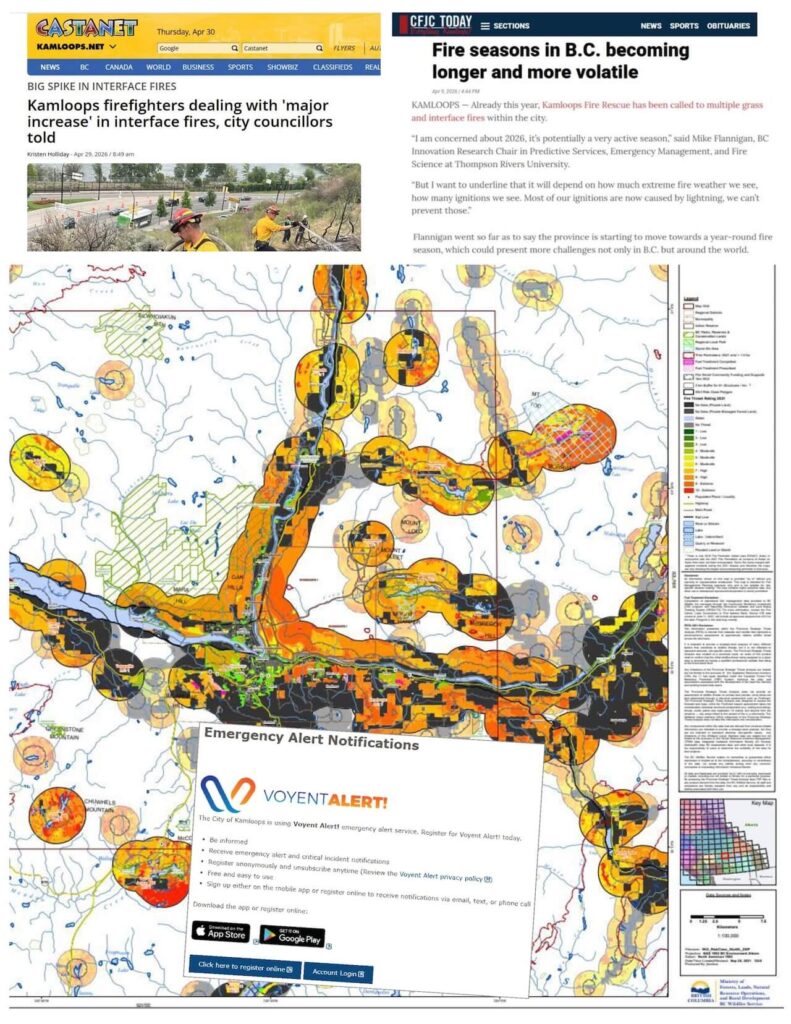
 As always, people are encouraged to sign up for Voyent Alert (app, text, email, or phone alerts).
Sources:
BC Ministry of Forests Wildland Urban Interface Risk
Analysis ranking Kamloops and Kelowna as the most wildfire-vulnerable cities in Canada in 2025, using FSR Forecast Severity Rating and FSA Forecast Severity Anomaly to predict and compare fire conditions:
City of Kamloops Wildfire information






0 Comments